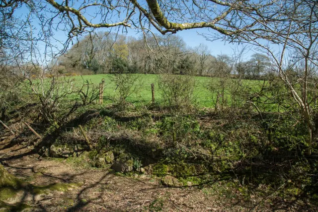
Cairnfield above the Blackaton Brook, west of Stoneyhurst
A cairnfield of at least 25 mounds, with a kerbed funerary cairn and two lengths of walling that show a field system was starting to be laid out, above the Blackaton Brook.
“The longer one stays here the more does the spirit of the moor sink into one's soul, its vastness, and also its grim charm.”
Who wrote this?
A Bronze Age cairnfield on the open moor northwest of Stoneyhurst, with multiple stone burial mounds.
Bronze Age cairnfield and settlement enclosure on the high moor east of Cuckoo Rock.
A cairnfield of two clusters of four cairns, averaging 0.4 m high, with a field walled by a rubble bank 2 m wide, on a south-east slope above the East Dart.
A cairnfield of at least eight mounds, 3.6 to 5.5 m across, a 9.5 m cairn, and 500 m of the Taw Marsh Reave on a north-west slope of Cosdon Hill.
At least 29 small cairns, five joined fields, a hut circle, a cairn with a cist and a ring cairn 17.5 m across south of Moorgate Farm below Row Tor, pitted by military training.
Two round cairns, 21 m and 25 m across, on a lower ridge north of Corndon Tor, the western one dug in the 1820s by about fifty people.
An Iron Age defended settlement on the summit of Berra Tor: an oval enclosure with a rampart up to 17 m wide and 1.7 m high.
The summit cairn of Cosdon, 27 m across and 3 m high, reused as a medieval beacon, with a ring cairn, a stone building and five post-medieval shelters.