

← Browse Prehistoric Settlements · Browse the directory
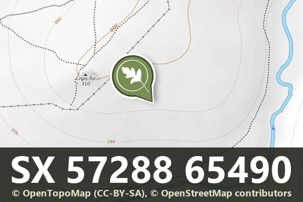
Historic England's scheduling record (list entry 1019876) describes an extensive prehistoric settlement, three round cairns, a post-medieval rabbit warren, two leats, two tinners' buildings and a little tin streamwork on the south side of Legis Tor, above the valley of the River Plym. The monument is surrounded on three sides by an alluvial tin streamwork that is not scheduled. It lies in the parish of Sheepstor, about 1 km north-west of Little Trowlesworthy Tor and 2.5 km south-east of Sheepstor.
The prehistoric settlement is a series of enclosures along the lower slopes of Legis Tor with 58 hut circles and several lengths of boundary wall. The largest enclosure is agglomerated, 135 metres north to south by 200 metres east to west, with six distinct areas bounded by rubble walls up to 3 metres wide and 1 metre high, and 19 huts inside, two free-standing and the rest attached to the walls. The huts are banks round circular spaces 2.5 to 7 metres across, averaging 4.97, with walls 0.3 to 1 metre high. Eight have visible doorways and two have porches. The Dartmoor Exploration Committee dug eight of them in 1895. The floors were level, the upper part unpaved subsoil and the lower part generally paved, and several huts had a stone hearth beside a cooking hole, many holding large pottery sherds. Some pottery has been called Neolithic, though recent work supports an Early Bronze Age date. They also found rounded cooking stones splintered by fire in large numbers, coarsely chipped flint flakes and scrapers, a triangular polished stone and a broken spindle whorl.
West of the big enclosure, sinuous banks form a field system linking an isolated hut and a semi-oval enclosure 45 metres by 22 metres, bounded on three sides by a rubble wall and on the fourth by a river scarp. Three D-shaped structures are attached to its east wall, 4 metres by 3 metres, 9.7 metres by 4.6 metres and 11 metres by 4 metres, very different from the other huts here and perhaps not Bronze Age homes. A small triangular building against its south wall is like some tinners' buildings. A hut attached to a wall that partly runs under the agglomerate enclosure shows an earlier phase of settlement before the enclosure, and its dig found Early Bronze Age pottery. East of the big enclosure are 11 more huts and, further east, three enclosures with six huts and a small D-shaped structure of unclear date and use, then six unenclosed huts (two of them two-roomed), a kidney-shaped enclosure 52 metres by 30 metres with three huts attached, four more unenclosed huts, and an easternmost sub-oval enclosure 100 metres by 95 metres with two yards, five huts and a further sub-division. One last hut stands on a narrow terrace right above the Plym.
On the hillslope above are three round cairns with kerbs of edge-set stones: the western 5.4 metres across, the central 6 metres across with a cist 0.9 metres long that the Committee examined in 1895 without finds, and the eastern 4 metres across with a damaged cist 0.6 metres long.
The rabbit warren, sometimes called New Warren, may once have worked jointly with Trowlesworthy Warren and later became part of Ditsworthy Warren. The name suggests an earlier warren, but there are no documents to date it, and the warren across the Plym at Trowlesworthy was established by 1292. Most of the warren is in this scheduling, with seven enclosed areas holding pillow mounds, flat-topped oblong mounds with quarry ditches and shallow gullies leading from the lower end. The gullies are traditionally read as drains but may also have been runs for rabbits and vermin, where traps could be set. Enclosures include the north-western (133 by 144 metres, one mound), the large western (375 by 300 metres, 15 mounds and one trap), two probable breeding areas, and three big eastern ones (550 by 150 metres with seven mounds and four traps, 470 by 180 metres with ten mounds, and a partly enclosed area with six mounds), plus six mounds outside any enclosure. The vermin traps are V- or X-shaped gullies or walls that funnel predators to a central point, with a slate in one narrow passage probably part of the trap's shutter. Mounds are 8 to 43 metres long.
Two leats cut through. The upper includes 800 metres of the Yeoland Consols leat, built in the 19th century to serve the Yeoland Consols mine at Clearbrook some 5 kilometres away, 1.7 metres wide and 0.7 metres deep, with granite slab footbridges across it. The second, 440 metres long, was disused before at least some pillow mounds were built, as two mound quarries cut its line, and was probably linked to streamworking in the Plym valley. A small area of alluvial streamwork has six parallel banks 3 metres wide and 1.3 metres high, worked eastwards with shovels, and it lies under a later pillow mound. Nearby are two tinners' buildings: a two-roomed one terraced into the river scarp with a small stone-lined compartment, and a single-room one with a fireplace whose lintel has collapsed. Three structures attached to the big agglomerate enclosure are post-medieval: a rectangular building 7 metres by 5 metres, a possible animal pound or shelter 9.5 metres by 6 metres, and a small cache 1.8 metres by 1 metre where tools or valuables could be hidden.
Sources: Historic England list entry 1019876, which cites Crossing's Dartmoor Worker (1992), Worth's Dartmoor (1981 edition), Fox, 'Early Settlement on Dartmoor and in North Wales' and Griffiths, 'Early Settlement in Caernarvonshire' (Archaeologia Cambrensis, vol 101, 1951), Baring-Gould in the Devonshire Association Transactions (the Third and Eighth Reports of the Dartmoor Exploration Committee, vol 34, 1902, among others), Gibson, Single Monument Class Description: Stone Hut Circles (1987), the National Archaeological Record (SX56NE154), a long run of Devon County Sites and Monuments Register records (SX56NE71, 239, 360, 465, 466 and 535, among others) and fieldwork for the Monuments Protection Programme by S. Gerrard.
- Period: Bronze Age
- Status: Scheduled monument (Historic England list entry 1019876)
- Grid reference: SX 5728 6549 (approximate, from the listing's coordinates)
Historic England listed designation: Prehistoric settlement, three round cairns and a post-medieval rabbit warren at Legis Tor
Contact us if you have information about this listing


Official record
Explore the area
Go deeper with Dartefacts
Dartefacts is a database of Dartmoor sites with far more close-up detail than we can show here, and it is the best place to go deeper. Dartefacts is free to use, and nobody has to pay to look things up. If you want more, a yearly subscription adds 10-figure grid references, map zoom down to 1:25,000 and lists to tick off the places you have visited, and it helps keep the site going. We would encourage you to subscribe.
More Dartmoor resources
Thoughts
Be the first to share a thought about Legis Tor settlement and warren.
Share a thought Photograph by Glavind Strachan Photography
“Please, mem, first there's a jacket, then a gownd, and then comes Oi.”
Also on Our DartmoorCairnfield on Longstone Hill — A Bronze Age cairnfield of at least 64 mounds in 26 scheduled monuments on the ridge and slopes of Longstone Hill, above the West Okement River.
Know another Dartmoor place, tor or landmark we should include? Suggest a listing, it is free.
Suggest a listing