

← Browse Tors & Landmarks · Browse the directory
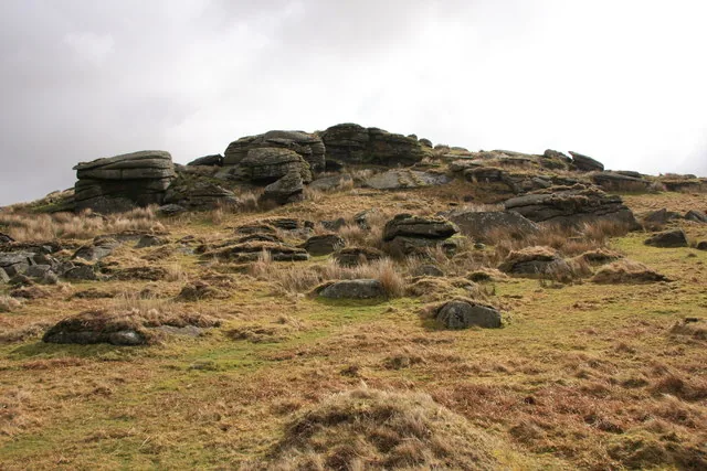
Main image: Photo: Guy Wareham, Wikimedia Commons
- Height: 390 m
- Grid reference: SX 5811 7199
- Parish: Walkhampton
- Rock: Granite
Hart Tor (Walkhampton Common) is a granite outcrop at SX 5811 7199, 390 m high, south-west of Princetown between Hart Tor Brook and the River Meavy. Eric Hemery called it a symmetrical pile that gives its name to the brook, and said it looks best from the river below. Older spellings include Har Tor and Harter Tor.
The slopes hold much prehistory. A scheduled hut circle 310 m north of the tor, 6.5 m across inside, belongs to an unenclosed hut circle settlement running towards Devil's Bridge. On the lower south-western slope a single and a double stone row, the double one of 93 stones and about 122 m long, run down to the Meavy. Tinners later cut across it with a ditch and a leat, and a stone beside the open tinworks is recorded as most probably a tinners' bound stone. There is also a disused rifle range to the north.
This is the southern of the two Hart Tors. The other, 436 m, is a small outcrop beside an observation post on Okehampton Common in the north.
This is a location on Dartmoor that has a namesake. Read more about this: Dartmoor Places With the Same Name
Contact us if you have information about this listing
Explore the area
Go deeper with Dartefacts
Dartefacts is a database of Dartmoor sites with far more close-up detail than we can show here, and it is the best place to go deeper. Dartefacts is free to use, and nobody has to pay to look things up. If you want more, a yearly subscription adds 10-figure grid references, map zoom down to 1:25,000 and lists to tick off the places you have visited, and it helps keep the site going. We would encourage you to subscribe.
Thoughts
Be the first to share a thought about Hart Tor.
Share a thoughtKnow another Dartmoor place, tor or landmark we should include? Suggest a listing, it is free.
Suggest a listing