Dartmoor quiz
Old books sometimes spell "Fice's Well" differently. Which of these is one of those spellings?


← Browse Tors & Landmarks · Browse the directory
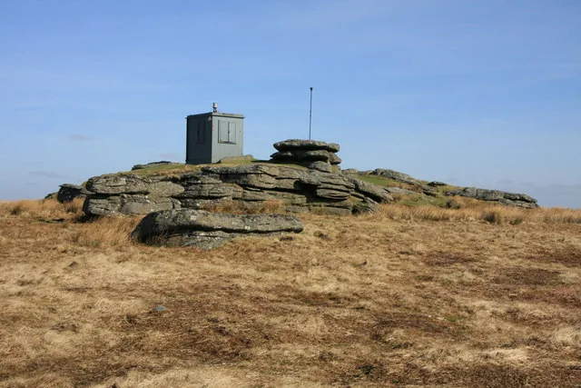
Main image: Photo: Guy Wareham, Wikimedia Commons
This Rough Tor is a reasonably flat tor deep on the northern moor, north of Two Bridges, at SX 605 798 and 547 m high. It sits within the Merrivale firing range, and its summit carries military huts and poles.
The views are long rather than dramatic, because the ground around the tor is flat. Cut Hill lies to the north, with Crow Tor and Beardown Tor to the south.
Dartmoor has several Rough Tors. The Tors of Dartmoor database also lists Rough Tor (Burrator), Rough Tor (West Dart), and a Great Rough Tor of 276 m in Roughtor Plantation, Sheepstor parish. Check the grid reference before assuming which one a walk description means.
This is a location on Dartmoor that has a namesake. Read more about this: Dartmoor Places With the Same Name
Contact us if you have information about this listing
Dartefacts is a database of Dartmoor sites with far more close-up detail than we can show here, and it is the best place to go deeper. Dartefacts is free to use, and nobody has to pay to look things up. If you want more, a yearly subscription adds 10-figure grid references, map zoom down to 1:25,000 and lists to tick off the places you have visited, and it helps keep the site going. We would encourage you to subscribe.
Be the first to share a thought about Rough Tor.
Share a thoughtOld books sometimes spell "Fice's Well" differently. Which of these is one of those spellings?
Know another Dartmoor place, tor or landmark we should include? Suggest a listing, it is free.
Suggest a listing