

← Browse Moretonhampstead · Browse Tors & Landmarks · Browse the directory
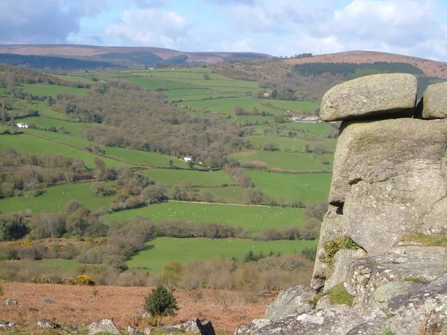
Hunter's Tor, Lustleigh Cleave
Moretonhampstead, Devon
Grid ref: SX 7603 8247 Find this on the Map Reference Finder
Main image: Photo: Derek Harper, Wikimedia Commons
- Parish: Lustleigh
- Height: 319 m
- Grid reference: SX 7604 8246
- Rock: Granite
Hunter's Tor sits at the north-western end of a rock-studded hillside above Lustleigh Cleave. Part of the large rock mass is built into a wall on the ridge apex, where the ground falls steeply to the River Bovey, and from below the tor looks like a leaning tower almost parallel to the slope. It is a striking viewpoint over much of eastern Dartmoor, taking in Haytor Rocks, Great Hound Tor, Bowerman's Nose and the plateau tops of Hamel Down and Mardon Down.
A hillfort lies on the hilltop a little above the tor, an oval enclosure about 116 m long and 70 m wide, with three concentric ramparts on the south-east side and two on the north-west, and an inturned entrance to the south-east. A hut circle lies between the middle and inner ramparts on the eastern side. A path reaches the tor from the north-west near Peck Farm.
The Hunter's Tor in the Teign Gorge, near Castle Drogo, is a different place, about 8 km to the north-west, across the eastern moor.
This is a location on Dartmoor that has a namesake. Read more about this: Dartmoor Places With the Same Name
Explore further
Contact us if you have information about this listing
Explore the area
Go deeper with Dartefacts
Dartefacts is a database of Dartmoor sites with far more close-up detail than we can show here, and it is the best place to go deeper. Dartefacts is free to use, and nobody has to pay to look things up. If you want more, a yearly subscription adds 10-figure grid references, map zoom down to 1:25,000 and lists to tick off the places you have visited, and it helps keep the site going. We would encourage you to subscribe.
Thoughts
Be the first to share a thought about Hunter's Tor, Lustleigh Cleave.
Share a thought Photograph by Glavind Strachan Photography
“Tincombe Lane is all uphill / Or downhill, as you take it; / You tumble up, and crack your crown, / Or tumble down and break it.”
Also on Our DartmoorTwo adjoining hut circles above Red Brook — Two adjoining hut circles, 8 m and 9 m across, above the right bank of Red Brook, the downstream one with an entrance flanked by upright stones.
Know another Dartmoor place, tor or landmark we should include? Suggest a listing, it is free.
Suggest a listing