

← Browse Tors & Landmarks · Browse the directory
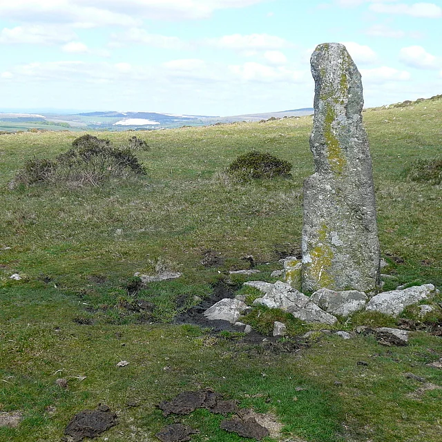
Main image: The thin boundary stone marked on maps as the Longstone, which stands about 180 m from the site of Black Tor, with open moor and the distant South Hams behind. Photo: Graham Horn (CC BY-SA 2.0) via Wikimedia Commons
- Parish: Ugborough
- Height: 350 m
- Grid reference: SX 6556 5844
- Rock: Granite (ruined, one small outcrop)
This is the smallest and least obvious of the Black Tors, and it is not wholly certain which rocks the name belongs to. It lies at about 350 m in Ugborough parish, just below Butterdon Hill. Tors of Dartmoor classes it as ruined: the likeliest site is a pile that has almost completely broken down. Ken Ringwood, writing in 2013, describes one tiny granite outcrop with a little loose rock around it, and Terry Bound in 1991 found no obvious pile, only a small stack about ten metres east of the boundary markers. There is a bench here, with distant views over the South Hams and, on a clear day, the coast.
The name comes from Samuel Rowe's Perambulation of Dartmoor (1848), which mentions a Black Tor above Black Pool, a large pond below it that he thought might almost be called a mountain tarn. Tors of Dartmoor considers this outcrop the only plausible match. It rejects the idea that Rowe meant Butterdon Hill itself, because he names that hill separately on the previous page.
A path from Black Pool to Butterdon Hill passes boundstones on the line between Harford and Ugborough parishes, a boundary with more markers than any other parish boundary on Dartmoor, over 80. One thin stone near the tor is marked on maps as the Longstone. The Piles Hill to Butterdon stone row ends just to the north-east.
Four tors on Dartmoor are called Black Tor. This is the one that is hardest to find and the only one whose identity is open to question.
Explore further
Contact us if you have information about this listing
Official record
Explore the area
Go deeper with Dartefacts
Dartefacts is a database of Dartmoor sites with far more close-up detail than we can show here, and it is the best place to go deeper. Dartefacts is free to use, and nobody has to pay to look things up. If you want more, a yearly subscription adds 10-figure grid references, map zoom down to 1:25,000 and lists to tick off the places you have visited, and it helps keep the site going. We would encourage you to subscribe.
Thoughts
Be the first to share a thought about Black Tor, Ugborough.
Share a thoughtKnow another Dartmoor place, tor or landmark we should include? Suggest a listing, it is free.
Suggest a listing