

← Browse Prehistoric Settlements · Browse the directory

Cherry Brook hut circle settlement and two cist cairns, near Powder Mills
Grid ref: SX 6243 7779
On walking routes: The Lichway
Main image: Photo: Alan Hunt, Wikimedia Commons
Historic England's scheduling record (list entry 1016638) describes a partly enclosed hut circle settlement, two cairns with cists and a post-medieval building on a south-east-facing slope above the valley of the Cherry Brook. The scheduling falls into seven areas. It lies in the parish of Dartmoor Forest, about 0.9 km east of Longaford Tor and 2.8 km south-west of Postbridge.
The settlement is a single enclosure with four huts inside or joined to it, eight more huts to the south and two to the east. The huts are circular or oval banks round spaces of 7 to 33 square metres, averaging 15, with walls 0.2 to 1.2 metres high, averaging 0.6. Seven have visible doorways, three are attached to the enclosure walls and one has an inner partition. On the east edge are two cairns with cists. The northern is 5.4 metres across and up to 0.6 metres high, ringed by a kerb that includes one substantial upright stone which may once have stood. Its cist, in the middle, is 1.05 metres by 0.68 metres and 0.7 metres deep, running north-north-east to south-south-west, with its displaced cover stone, 1.95 metres by 1 metre and at least 0.18 metres thick, lying on the south-east edge. The southern cairn is 5.8 metres across and 0.5 metres high with a central pit marked on its north side by a slab 1.4 metres long and 0.55 metres deep, one side of a cist damaged by partial excavation or robbing, and a few edge-set stones suggest a kerb that mostly survives buried.
The post-medieval building cuts through the prehistoric enclosure wall. It is a single-room dwelling, 6.3 metres by 3.5 metres inside, with a faced drystone wall 0.65 metres wide and up to 1.7 metres high and a fireplace against the north-west wall. A linhay is attached to the south-west wall, 8.3 metres by 2.6 metres inside, its open south-east side marked by three big upright stones up to 1.8 metres high that would have carried a roof.
Sources: Historic England list entry 1016638, which cites an archaeological survey and evaluation of Powder Mills and Gawler (1989), Haynes, Ruined Sites on Dartmoor: Middleworth (1966, unpublished manuscript) and fieldwork for the Monuments Protection Programme by S. Gerrard (1998). Guy Wareham has added photographs of the cist at SX 6257 7790 in a comment on the Historic England page; I have not used them.
- Period: Bronze Age
- Status: Scheduled monument (Historic England list entry 1016638)
- Grid reference: SX 6243 7779 (approximate, from the listing's coordinates)
Contact us if you have information about this listing
Official record
Explore the area
Go deeper with Dartefacts
Dartefacts is a database of Dartmoor sites with far more close-up detail than we can show here, and it is the best place to go deeper. Dartefacts is free to use, and nobody has to pay to look things up. If you want more, a yearly subscription adds 10-figure grid references, map zoom down to 1:25,000 and lists to tick off the places you have visited, and it helps keep the site going. We would encourage you to subscribe.
More Dartmoor resources
Thoughts
Be the first to share a thought about Cherry Brook hut circle settlement and two cist cairns, near Powder Mills.
Share a thought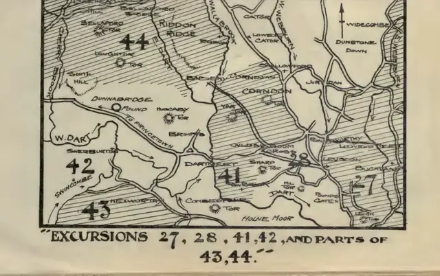 Plate from Guide to Dartmoor, page 161, 1909
“The fogs are most deceptive and very tricky. They come on unexpectedly, and change the whole aspect of the surroundings. They magnify all things ; hills comparatively small appear as high mountains, and a small bird like a snipe looks as big as a pigeon.”
Also on Our DartmoorMiddle Bonehill Farmhouse, Front of Right Hand Side of House — A Grade II* listed farmhouse with its front garden wall, standing on Dartmoor with roots in the post-medieval farming tradition.
Know another Dartmoor place, tor or landmark we should include? Suggest a listing, it is free.
Suggest a listing