

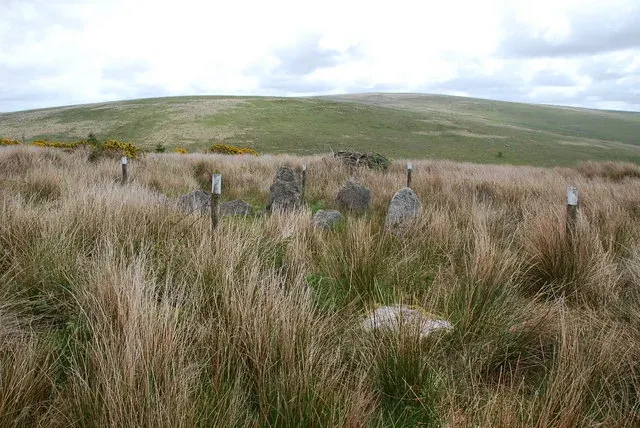
Kerbed cairn near Yealm Steps
A kerbed cairn with a cist on the ridge between the River Yealm and Broadall Lake: nine kerbstones up to 1.1 m high round a cist 1.2 m long.
Showing listings tagged “Historic England” Show all listings
A kerbed cairn with a cist on the ridge between the River Yealm and Broadall Lake: nine kerbstones up to 1.1 m high round a cist 1.2 m long.
A hut circle settlement above the O Brook: at least three enclosures and 18 huts, with a fine 0.7 m entrance flanked by slabs up to 0.75 m high, a cairn over a hut and prospecting pits.
A cairn 5.6 m across ringed by edge-set slabs up to 0.62 m high, with a cist 1.2 m by 0.55 m partly covered by three slabs, on a saddle between Hookney Tor and King Tor.
A cairn 6 m across with a possible kerb and a cist 1.3 m long with the east end stone and cover stone displaced, south of the Langcombe Brook.
A cairn 5.5 m across containing a stone-lined cist 1.2 m long, 150 m north of Vixen Tor, at the edge of a coaxial field system.
The original site of Watching Place Cross, with an 18th-century granite waymarker lettered C, M and T for Chagford, Moreton and Tavistock.
A 44 m motte 4 m high with two baileys beside an oval Iron Age hillfort with a double rampart, 144 m by 94 m, and five more banks and ditches on its south side, in Burley Wood.
A medieval cross head and short shaft, 1.02 m high, carved with a relief cross on two faces, found elsewhere on the farm and set up at the Moor Gate Farm entrance in 1937; Grade II.
A stumpy-armed medieval cross, 1.04 m high, at Bovey Cross crossroads, with the letters O, N and M cut for Okehampton, Newton and Moreton; Grade II, also called Stumpy Cross and Horspit Cross.
