Higher White Tor stone row
A double stone row 95.4 m long on the south slope of Higher White Tor, with 12 stones standing and 24 fallen, the tallest 0.75 m.
Showing listings tagged “Historic England” Show all listings
A double stone row 95.4 m long on the south slope of Higher White Tor, with 12 stones standing and 24 fallen, the tallest 0.75 m.
A cairnfield of ten mounds, 3.5 to 7.5 m across, scattered round the edge of a field on a south-facing slope above the Willsworthy Brook.
“The peat glowed as though it were red-hot, and night brooded on the eastern face of every hill.”
Who wrote this?
A round cairn 12 m across and 0.6 m high on the summit of Great Gnats' Head, with a kerb of edge-set stones in places and a modern stone pile on top.
A round cairn 7.3 m across and 0.8 m high on a north-west slope of Cosdon Hill, with edge-set stones that suggest a buried kerb and a hollow on the north side.
A round cairn 17 m across and 1.5 m high with a kerb and a robbing pit, on Hingston Hill, in direct line with the two end stones of a stone row to its south-west.
Two enclosures and a cluster of stone hut circles on the west-facing slope of Lee Moor above Spanish Lake: a Bronze Age settlement.
A hut circle settlement in four areas on the upper south-west slope of Combshead Tor, huts of upright-stone walls 0.7 to 1 m high, 13.1 to 50.2 square metres inside.
A hut circle 6.5 m across inside with a wall 2.7 m wide and a south doorway, on the west edge of a large settlement above the Meavy.
A stone hut circle 6 m across inside with a west-facing doorway protected by a porch, at the south-west edge of the Arms Tor settlement.
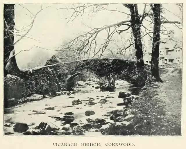
Plate from A Hundred Years on Dartmoor, page 115, 1901“The rain stopped suddenly, and the wind was hushed, except in the tops of invisible trees; and a streak of black boggy fog settled heavily.”
Also on Our DartmoorNorsworthy Bridge — A modest stone bridge crossing the West Dart River, where moorland paths converge in one of Dartmoor's quieter valleys.