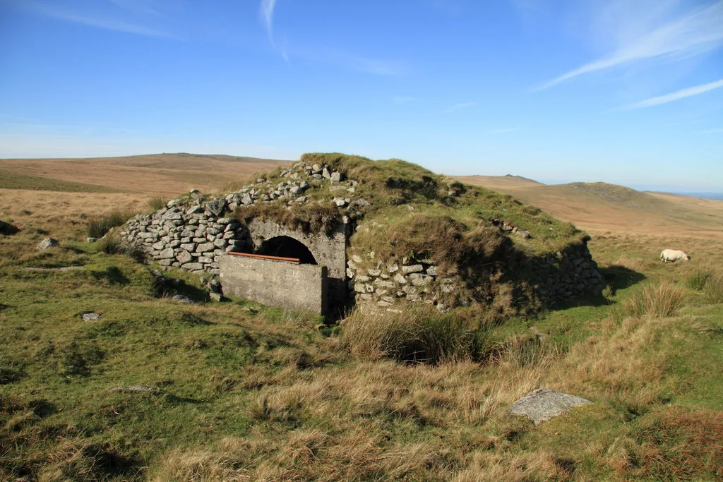
Historic England's scheduling record (list entry 1425411) describes Observation Post 16, a stone- and earth-covered concrete splinter-proof shelter, also known as a bunkhouse, and its flanking artillery target butts, in an extensive area of shell craters 737 metres north-east of the summit of Okement Hill. It lies in the parish of Dartmoor Forest, about 1.1 km south-west of Steeperton Tor.
The shelter, centred on SX 6082088190, is cast concrete under a large mound of turf and boulders. It is 3.2 metres north to south by 2 metres inside, with coursed granite walls and an arched roof that seems to have been cast in place. The south front has a cast concrete blast wall 1.5 metres high with a handrail on top, which would have been used to feed a system of cable pulleys that moved targets in the flanking trenches. A gap between the blast wall and the side of the mound is the way in. The mound is roughly rectangular, about 11 metres by 8 metres and up to 3.9 metres high, with its sides held by a coursed boulder revetment 2 metres high, and the top is eroded in places.
The shelter is flanked by two target butts, both much damaged by shell fire. The east butt is the larger, a disturbed bank 29 metres long running about east to west with a ditch on the south side. The main bank is 4.5 metres wide and up to 1.5 metres high, with traces of sharp, steeply sloping sides and a flat top, and the ditch averages 4 metres wide and 1 metre deep with several deliberate kinks whose purpose is no longer clear. A lower bank a few metres south, 17 metres long, 4 metres wide and 1 metre high, is more damaged. The trench west of the shelter is a smaller single trench about 15 metres long, built like the other butt. The scheduling is in three areas.
Sources: Historic England list entry 1425411, which cites English Heritage Pastscape monument nos. 967045 and 966994 (accessed 22 January 2015), Probert, Okehampton Range: Monument Baseline Condition Survey (2004) and Francis, Okehampton Artillery Range, Devon: Report and Photographic Survey (2002).
Status: Listed building (Historic England list entry 1425411)
Grid reference: SX 6082 8819 (approximate, from the listing's coordinates)
Dartefacts is a database of Dartmoor sites with far more close-up detail than we can show here, and it is the best place to go deeper. Dartefacts is free to use, and nobody has to pay to look things up. If you want more, a yearly subscription adds 10-figure grid references, map zoom down to 1:25,000 and lists to tick off the places you have visited, and it helps keep the site going. We would encourage you to subscribe.
Our Dartmoor doesn't track you and runs no adverts. We use one cookie to make the
site work, and some pages load videos, maps or optional social media panels from other sites, the panels only if you choose to show them.