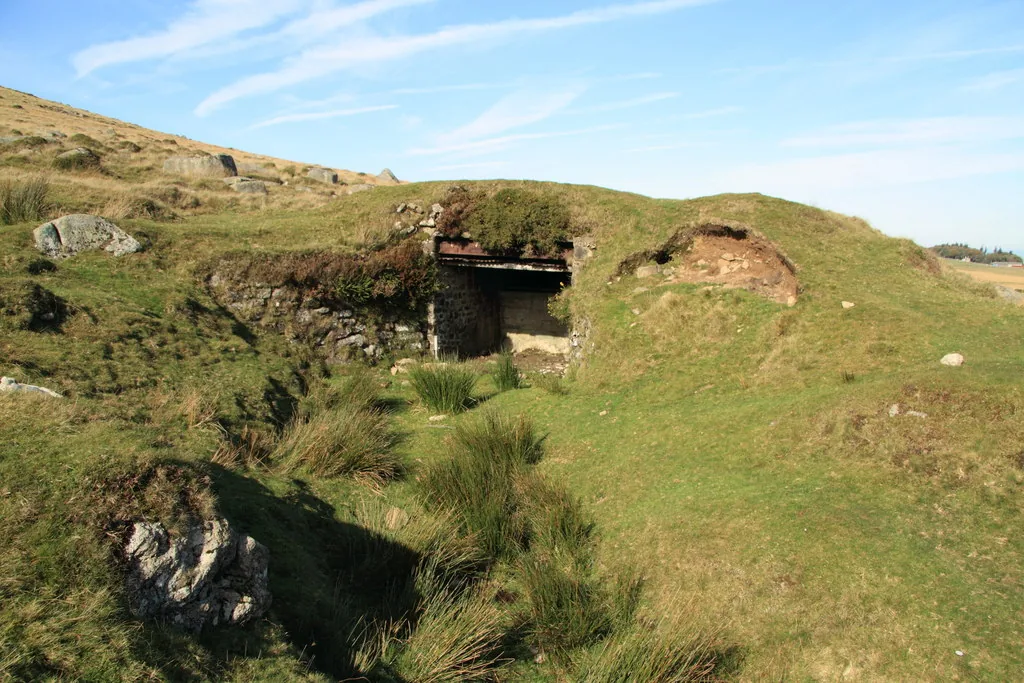
Historic England's scheduling record (list entry 1424332) describes an inclined target carrier railway of about 1895 on the Okehampton artillery range, with a long curving cutting that follows the east slope of East Mill Tor, partly taken into the Loop Road, ending at Skit Bottom 175 metres south of the East Okement Farm enclosures, and the former trolley shed, now called Observation Post 6. It lies in the parish of Dartmoor Forest, about 1 km west of Oke Tor.
OP6 is a turf-covered stone shelter with concrete lining, 6.4 metres north to south by 2.5 metres, rising to 2 metres above ground, and forms a mostly turf-covered mound. The entrance to the south is protected by a steep, splayed stone cutting, with a wide portal carried on a timber lintel, and the inside has a corrugated iron ceiling on evenly spaced timber cross beams. The side and rear walls are exposed rubble stone, and the inside is divided in two by a chest-high cast concrete partition with iron rungs on its outer face and a steel handrail on top.
The embanked cutting that formed the head of the railway leads south-east from OP6, makes a sharp U-turn north and drops through a steep-sided cutting averaging 2.8 metres wide at the base and 1.8 metres deep. At SX 6029490193 the cutting ends and the trackbed joins the Loop Road, leaving it east at SX 6035590416. A short branch curving north-east between SX 6041390486 and SX 6039690600 may be the earlier course of the railway or served the target trolleys. At the north end of the trackbed, at SX 60419073, is an L-shaped mound about 4.5 metres long of stone with corrugated iron, of unknown function and possibly early to mid-20th century. Timber sleepers about a metre apart show along the trackbed and cast-iron sleepers and track chairs are recorded in the north, and the gauge appears to have been about 20 inches. The scheduling is in two areas, and excludes the military Loop Road, the branch earthworks and the L-shaped mound.
Sources: Historic England list entry 1424332, which cites English Heritage Pastscape monument no. 832018, the government paper The Armed Forces on Dartmoor: A Brief History, the National Archives map WO78/4547 (Okehampton camp and artillery ranges, 1892, reproduced 1906), Francis, Okehampton Artillery Range, Devon: Report and Photographic Survey (2002, unpublished) and Probert, Okehampton Range: Monument Baseline Condition Survey (2004).
- Status: Listed building (Historic England list entry 1424332)
- Grid reference: SX 6035 9026 (approximate, from the listing's coordinates)