Status: Four scheduled monuments (Historic England entries listed below)
Cairns: Six in all, 3.5 m to 15.5 m across, four with a stone cist
Where: South, south-east and east-north-east of Down Tor
A round cairn is a mound of stones over a burial, and a cist is the stone-lined box inside it. Four scheduled monuments around Down Tor hold six cairns. Closest to the tor, 100 m south, is a small round cairn 4.3 m across whose centre has been dug out to show a cist 0.7 m long, 0.45 m wide and 0.5 m deep; its 1.8 m capstone lies displaced just to the south. Three small cairns 370 m east-north-east, in a valley between Down Tor and Hingston Hill, each hold a cist. The eastern one has a kerb of large edge-set stones and a cist 1.19 m by 0.71 m and 0.94 m deep; the western one is 6.25 m away; the third is an oval mound whose cist, 0.53 m long, is one of the smallest still in place on Dartmoor, and a leat 0.8 m wide runs between it and the western cairn.
Sixty metres south-east of the tor is a tor cairn, built against a granite outcrop: a horseshoe of edge-set stones, with two parallel lines 4.3 m long running from the rock. The biggest cairn here is on the saddle 615 m east-south-east, 15.5 m across and up to 1.5 m high, with a T-shaped trench cut into the centre; three small tin prospecting pits press against its edge.
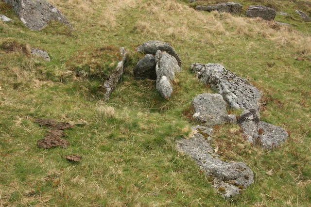
A tor cairn: a horseshoe of edge-set stones against a granite outcrop, two parallel lines 4.3 m long on the north and nine stones on a boulder on the south.
Three small round cairns, each with a cist: the eastern 4.5 m across with a kerb, the western 5 m across, and an oval one with one of Dartmoor's smallest cists.
The 4 rings on this map are the separate scheduled monuments that make up this listing, placed from Historic England’s records. Tap a ring for its grid reference and a link to its official entry. The pin marks the middle of the group.
Dartefacts is a database of Dartmoor sites with far more close-up detail than we can show here, and it is the best place to go deeper. Dartefacts is free to use, and nobody has to pay to look things up. If you want more, a yearly subscription adds 10-figure grid references, map zoom down to 1:25,000 and lists to tick off the places you have visited, and it helps keep the site going. We would encourage you to subscribe.
Our Dartmoor doesn't track you and runs no adverts. We use one cookie to make the
site work, and some pages load videos, maps or optional social media panels from other sites, the panels only if you choose to show them.