

← Browse Prehistoric Settlements · Browse the directory
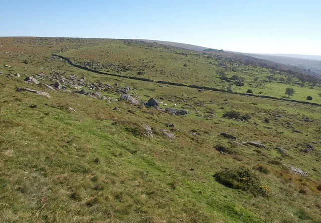
Hut circles near Down Tor
Walkhampton, Yelverton, Devon
Grid ref: SX 5783 6916
Main image: Photo: Derek Harper (CC BY-SA 2.0) via Wikimedia Commons
- Period: Bronze Age
- Status: Three scheduled monuments (Historic England entries listed below)
- Huts: Five, from 4.5 m to 8.9 m across inside
- Where: The south and south-west slopes of Down Tor, above the Narrator Brook
Down Tor's south and south-west slopes look down on the valley of the Narrator Brook, and three scheduled monuments there hold five stone hut circles. Each is a low wall of stone and earth round a circular floor, terraced into the hillside. The nearest is 160 m south of the tor, a pair 3.5 m apart: the western hut is 7.7 m across inside, with a wall 1.7 m wide and up to 1.1 m high and a doorway lined with slabs facing south-south-east, and the eastern one is 4.5 m across. A single hut 240 m south of the tor is 7 m across inside, with a wall 1.5 m wide and up to 0.9 m high and a doorway facing south. A pair 570 m south-west of the tor is bigger, 8.9 m and 8 m across; a later tin openwork has cut away the southern half of the eastern one, though its original shape is still clear.
A larger settlement of 14 huts inside an enclosure lies 540 m to the south-east and is described on the enclosed settlement page.
The three scheduled monuments
| Historic England entry | Grid reference | What survives |
|---|---|---|
| 1008640 | SX 57990 69235 | Two huts 3.5 m apart: the western 7.7 m across inside, with a slab-lined doorway facing SSE, and the eastern 4.5 m across. |
| 1008641 | SX 57972 69149 | One hut 7 m across inside, with a wall 1.5 m wide and up to 0.9 m high and a doorway facing south. |
| 1019572 | SX 57557 69114 | Two huts 8.9 m and 8 m across inside; a later tin openwork has removed the southern half of the eastern one. |
Grid references are from the Historic England entries. Each entry covers one scheduled monument; a monument can hold several features.
Contact us if you have information about this listing
The 3 rings on this map are the separate scheduled monuments that make up this listing, placed from Historic England’s records. Tap a ring for its grid reference and a link to its official entry. The pin marks the middle of the group.
Official record
Explore the area
Go deeper with Dartefacts
Dartefacts is a database of Dartmoor sites with far more close-up detail than we can show here, and it is the best place to go deeper. Dartefacts is free to use, and nobody has to pay to look things up. If you want more, a yearly subscription adds 10-figure grid references, map zoom down to 1:25,000 and lists to tick off the places you have visited, and it helps keep the site going. We would encourage you to subscribe.
Thoughts
Be the first to share a thought about Hut circles near Down Tor.
Share a thoughtKnow another Dartmoor place, tor or landmark we should include? Suggest a listing, it is free.
Suggest a listing