

← Browse Cairns & Barrows · Browse the directory
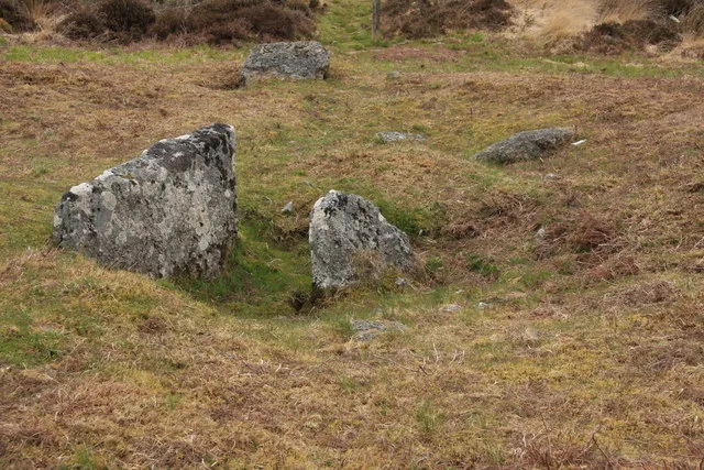
Cairns, cists and excavated hut circle on the east slope of Lakehead Hill
Grid ref: SX 6468 7735
On walking routes: Bellever Trail, Postbridge Trail, The Lichway
Main image: Cist on Lakehead Hill - 49 metres from location - image by Guy Wareham (CC BY-SA 2.0), via Wikimedia Commons
Historic England's scheduling record (list entry 1018511) describes two cairns, each with a cist, and a stone hut circle on a gentle east-facing slope of Lakehead Hill. The scheduling falls into three areas. It lies in the parish of Dartmoor Forest, about 0.9 km north of Bellever Tor and 0.8 km west of Bellever.
The northern cairn is a mound 18 metres across and up to 0.6 metres high, with several edge-set stones on the east, west and south sides showing a kerb. Its profile may suggest an inner ring bank, though that may come from early partial excavation or robbing. The middle has certainly been disturbed, and in one of the hollows is a substantial cist marked by two edge slabs 0.75 metres apart and up to 0.95 metres high. The southern cairn is a small mound 4.5 metres across and up to 0.2 metres high, with a three-sided cist in the middle running north-north-west to south-south-east, 1.1 metres long, 0.75 metres wide and 0.42 metres deep inside. When the Dartmoor Exploration Committee part excavated it in 1914 they found a pit holding charcoal.
The hut circle is a circular space 4.4 metres across inside a wall of upright stones 1.6 metres wide and up to 0.4 metres high, with a south-facing gap that may be the doorway. The Committee part excavated it in 1896 and found charcoal, three flint flakes and sherds of Bronze Age pottery.
Sources: Historic England list entry 1018511, which cites Butler, Dartmoor Atlas of Antiquities (1991), page 51, and vol 5, The Second Millennium BC (1997), page 184, and the Devon County Sites and Monuments Register (SX67NW30, 1994).
- Period: Bronze Age
- Status: Scheduled monument (Historic England list entry 1018511)
- Grid reference: SX 6468 7735 (approximate, from the listing's coordinates)
Historic England listed designation: Two cairns with two cists and a stone hut circle on the east facing slope of Lakehead Hill forming part of a ritual complex
Contact us if you have information about this listing


Official record
Explore the area
Go deeper with Dartefacts
Dartefacts is a database of Dartmoor sites with far more close-up detail than we can show here, and it is the best place to go deeper. Dartefacts is free to use, and nobody has to pay to look things up. If you want more, a yearly subscription adds 10-figure grid references, map zoom down to 1:25,000 and lists to tick off the places you have visited, and it helps keep the site going. We would encourage you to subscribe.
More Dartmoor resources
Thoughts
Be the first to share a thought about Cairns, cists and excavated hut circle on the east slope of Lakehead Hill.
Share a thought Photograph by Glavind Strachan Photography
“Let him now give his pony his head, and he will pick his own way, in such a path, much better than the rider could do it for him with the bridle. My little shaggy Dobb carries me up this hill as quietly as a lamb; I let the rein hang loose on my arm, and, whilst he paces gently on, amuse myself ...”
Also on Our DartmoorArthur B. Prowse — Doctor and indexer (M.D., F.R.C.S.), one of the first members invited to the Grimspound dig of 1894, who compiled the Devonshire Association's indexes to Risdon and to Dartmoor.
Know another Dartmoor place, tor or landmark we should include? Suggest a listing, it is free.
Suggest a listing