

← Browse Stone Rows & Alignments · Browse the directory
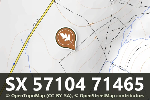
Historic England's scheduling record (list entry 1011255) describes a double stone alignment and three round cairns on the crest of a south-facing slope overlooking the valley of the River Meavy. The alignment runs north-east to south-west and is a double row 283.6 metres long of at least eighty-one stones, averaging 0.5 to 0.8 metres high. Sixty stones in the southern row can be seen, though more may be buried in the post-medieval field wall that runs parallel and right beside it. The northern row has at least twenty-one stones visible within the later field boundary. At the north-east end is a blocking stone 0.8 metres high, 1.2 metres wide and 0.2 metres thick, partly buried under the field wall. It lies in the parish of Walkhampton, about 0.9 km east of Leeden Tor and 2.8 km south-west of Princetown.
Three cairns lie at the south-west end. The largest is 6 metres from the identified end of the row and measures 9 metres by 4 metres and 0.8 metres high, partly under the field boundary. The second, north-east of it, is 5 metres across and 0.5 metres high, with a hollow in the middle that suggests partial early excavation or robbing. The third, south-east of the second, is 3.5 metres across and 0.4 metres high. Many other cairns south of the row are not included, because they probably belong to post-medieval field clearance.
Sources: Historic England list entry 1011255, which cites Worth's Dartmoor (1981 edition), pages 212 to 213, Robinson, Stone Row SW of Black Tor (AM107, 1983), the National Archaeological Record (SX57SE35), the Devon County Sites and Monuments Register (SX57SE102) and fieldwork for the Monuments Protection Programme by S. Gerrard.
- Period: Bronze Age
- Status: Scheduled monument (Historic England list entry 1011255)
- Grid reference: SX 5710 7146 (approximate, from the listing's coordinates)
Contact us if you have information about this listing


Official record
Explore the area
Go deeper with Dartefacts
Dartefacts is a database of Dartmoor sites with far more close-up detail than we can show here, and it is the best place to go deeper. Dartefacts is free to use, and nobody has to pay to look things up. If you want more, a yearly subscription adds 10-figure grid references, map zoom down to 1:25,000 and lists to tick off the places you have visited, and it helps keep the site going. We would encourage you to subscribe.
More Dartmoor resources
Thoughts
Be the first to share a thought about Stanlake double stone row and cairns.
Share a thoughtKnow another Dartmoor place, tor or landmark we should include? Suggest a listing, it is free.
Suggest a listing