

← Browse Cairns & Barrows · Browse the directory
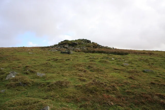
Round cairns and a platform cairn on Raddick Hill
Walkhampton, Yelverton, Devon
Grid ref: SX 5779 7106
Main image: Photo: Guy Wareham (CC BY-SA 2.0) via Wikimedia Commons
- Period: Bronze Age
- Status: Four scheduled monuments (Historic England entries listed below)
- Cairns: Five, 5.5 m to 12 m across
- Where: The Raddick Hill plateau and the slope towards Cramber Tor and Hart Tor Brook
Away from the cairnfield, four scheduled monuments hold larger burial cairns on and around the Raddick Hill plateau. Sixty metres north of the summit is a platform cairn, 12 m across and up to 1.2 m high; the Dartmoor Exploration Committee dug into it in 1898 and found a cist, already robbed, that held a small piece of corroded bronze. Two round cairns 140 m south-west of the summit, 7.3 m and 6 m across, were opened in the same year; the smaller had a pit under a cairn of small stones, with a cist filled with charcoal and earth, and a large flat stone between them may be the capstone of the western one.
A round cairn 650 m west-south-west of the summit is steep-sided, 5.5 m across and up to 0.8 m high. Another, 280 m north-east of the summit on the slope of Cramber Tor, is 7 m across and up to 1.2 m high with a hollow in the middle. The Committee's report named it as the cairn that held the bronze, but Historic England thinks the platform cairn is the likelier source.
The four scheduled monuments
| Historic England entry | Grid reference | What survives |
|---|---|---|
| 1007418 | SX 57924 71151 | A platform cairn 12 m across and up to 1.2 m high, with a robbed cist (0.7 m long) and two possible satellite cairns. |
| 1007427 | SX 57826 70977 | Two round cairns 7.3 m and 6 m across, 1 m apart, both opened in 1898; a large flat stone lies between them. |
| 1007424 | SX 57349 70849 | A steep-sided round cairn 5.5 m across and up to 0.8 m high. |
| 1007428 | SX 58092 71305 | A round cairn 7 m across and up to 1.2 m high with a hollow in the middle, on the slope of Cramber Tor. |
Grid references are from the Historic England entries. Each entry covers one scheduled monument; a monument can hold several features.
Contact us if you have information about this listing
The 4 rings on this map are the separate scheduled monuments that make up this listing, placed from Historic England’s records. Tap a ring for its grid reference and a link to its official entry. The pin marks the middle of the group.
Official record
Explore the area
Go deeper with Dartefacts
Dartefacts is a database of Dartmoor sites with far more close-up detail than we can show here, and it is the best place to go deeper. Dartefacts is free to use, and nobody has to pay to look things up. If you want more, a yearly subscription adds 10-figure grid references, map zoom down to 1:25,000 and lists to tick off the places you have visited, and it helps keep the site going. We would encourage you to subscribe.
Thoughts
Be the first to share a thought about Round cairns and a platform cairn on Raddick Hill.
Share a thoughtKnow another Dartmoor place, tor or landmark we should include? Suggest a listing, it is free.
Suggest a listing