

← Browse Dartmoor Walking Routes · Browse the directory
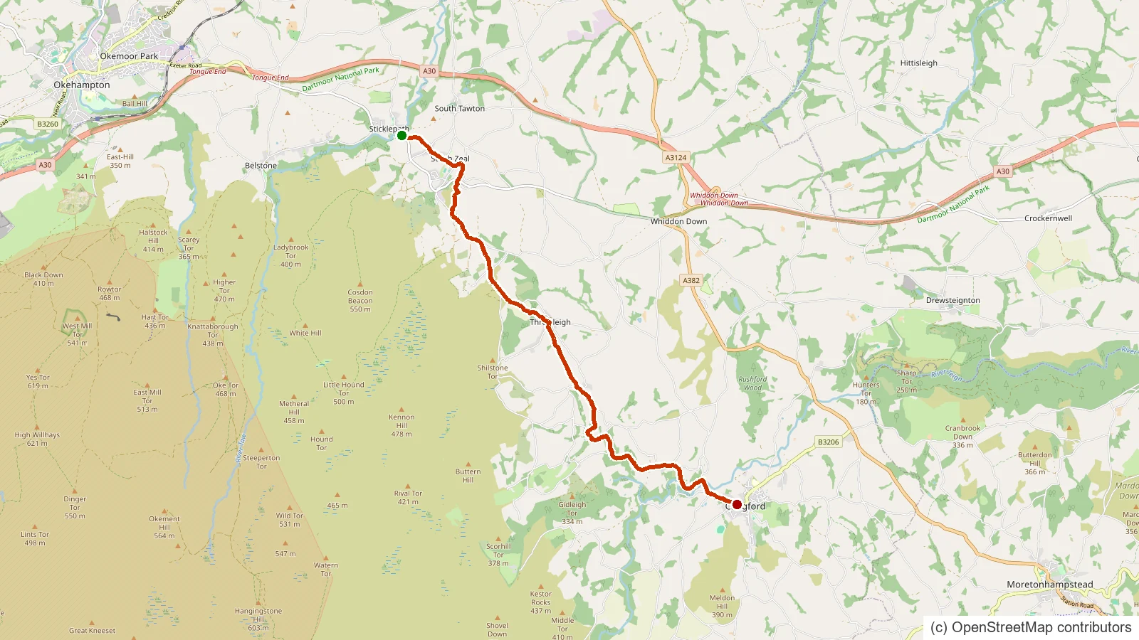
Taw Teign Link is a long-distance walking route of about 11 km on and around Dartmoor.
Route data © OpenStreetMap contributors (ODbL); mapped from OSM relation 2304117.
Suggest an edit to this listing
Contact us if you have information about this listing
- About 10.7 km
- Starts near Sticklepath, Devon
- A GPS track to follow (it may not include turn-by-turn waypoints)
Take this route with you
Download the GPX file, then open it in your favourite walking app or website:
Route data © OpenStreetMap contributors (ODbL). Rendered by Our Dartmoor.
Thoughts
Be the first to share a thought about Taw Teign Link.
Share a thought Scorhill - Cool Angle. Photograph by Glavind Strachan Photography
“This little feeder takes its rise at the foot of Cut Hill, issuing out of a black, swampy, almost uncanny looking place; a hollow filled with bog from which the stream oozes in a slow, lifeless sort of way.”
Also on Our DartmoorGreat Houndtor Farmhouse — A Grade II* listed farmhouse on the high moor, likely medieval in origin.
Know another Dartmoor place, tor or landmark we should include? Suggest a listing, it is free.
Suggest a listing