

← Browse Rivers & Waterways · Browse the directory
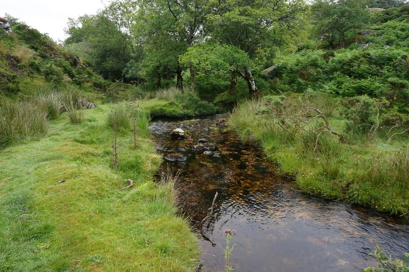
Main image: A clear stream running through grass and trees, titled North Walla Brook. Photo: jeff collins (CC BY-SA 2.0) via Wikimedia Commons
- Source: Near the Warren House Inn
- Course: North, then east, towards the River Bovey
- Not to be confused with: Walla Brook (Babeny), which also rises near the Warren House Inn but flows south
North Walla Brook starts near the Warren House Inn, the same place as the other Walla Brook that runs south to the East Dart, but it flows the opposite way: north and then east towards the River Bovey. It is one of four Dartmoor streams called Walla Brook.
Its valley is on the north eastern side of the moor, around North Bovey and Lakeland, where open moor gives way to small fields. Photographers record it from the Two Moors Way and from the track to Lakeland Farm, with Kes Tor and Cosdon Hill on the skyline.
Very little has been written about it. Wikipedia gives only its course, so there is no confirmed length or grid reference for the source here. To tell it from its namesakes, remember that it heads for the Bovey, while the Walla Brook near Babeny joins the East Dart, the one at Hangingstone Hill joins the North Teign and the one at Doe Tor joins the Lyd.
Suggest an edit to this listing
Contact us if you have information about this listing
Official record
Explore the area
Go deeper with Dartefacts
Dartefacts is a database of Dartmoor sites with far more close-up detail than we can show here, and it is the best place to go deeper. Dartefacts is free to use, and nobody has to pay to look things up. If you want more, a yearly subscription adds 10-figure grid references, map zoom down to 1:25,000 and lists to tick off the places you have visited, and it helps keep the site going. We would encourage you to subscribe.
Thoughts
Be the first to share a thought about North Walla Brook.
Share a thoughtKnow another Dartmoor place, tor or landmark we should include? Suggest a listing, it is free.
Suggest a listing