

← Browse Tors & Landmarks · Browse the directory
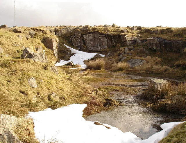
Main image: Photo: Andrew Hackney, Wikimedia Commons
- Height: 481 m
- Grid reference: SX 5711 7454
- Parish: Dartmoor Forest (formerly Walkhampton)
- Rock: Granite
- Also called: Stone Tor (Hemery), Billy's Tor
Hollow Tor is a small, fairly isolated granite outcrop beside the road at Rundlestone. It has good climbing and views over the North Moor. The highest point has the faint remains of a rock basin, no longer intact, and a small quarry has been cut into the north face.
The name needs care. The Walkhampton Tithe Map labels Rundlestone Tor as Stone Tor, not Hollow Tor, and Tors of Dartmoor says Eric Hemery wrongly tied that label to quarrying in the early 19th century. According to Nigel Tigwell, the quarry licence was granted to Billy Easterbrook in the 1930s. Hemery listed Billy's Tor as a separate outcrop, but Tigwell argues in 2012 that Billy's Tor is a local name for Hollow Tor. It is used now mainly by a few locals and former residents.
This is not the other Hollow Tor, on the west slope of Tor Hill at Widecombe.
This is a location on Dartmoor that has a namesake. Read more about this: Dartmoor Places With the Same Name
Contact us if you have information about this listing
Explore the area
Go deeper with Dartefacts
Dartefacts is a database of Dartmoor sites with far more close-up detail than we can show here, and it is the best place to go deeper. Dartefacts is free to use, and nobody has to pay to look things up. If you want more, a yearly subscription adds 10-figure grid references, map zoom down to 1:25,000 and lists to tick off the places you have visited, and it helps keep the site going. We would encourage you to subscribe.
Thoughts
Be the first to share a thought about Hollow Tor.
Share a thoughtKnow another Dartmoor place, tor or landmark we should include? Suggest a listing, it is free.
Suggest a listing