

← Browse Tors & Landmarks · Browse the directory
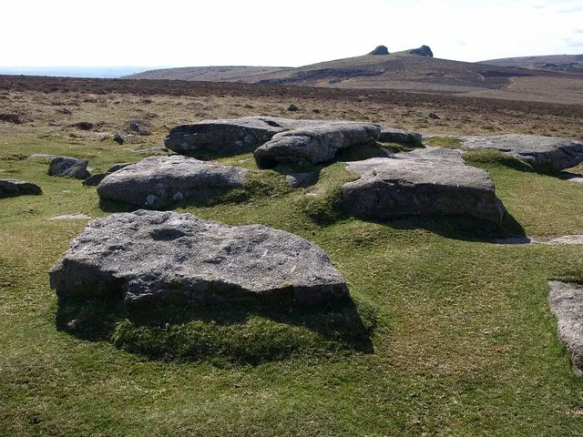
Black Hill
Haytor Vale, Bovey Tracey, Devon
Grid ref: SX 7604 7865
On walking routes: Templer Way
Main image: Photo: Derek Harper, Wikimedia Commons
- Height: 406 m (other sources differ)
- Grid reference: SX 762 789
Black Hill (SX 762 789) is a fairly flat-topped hill on the northern edge of Haytor Down, above the wooded valley of the River Bovey, given as 406 m. The true high point is a rock outcrop about 200 m south of the large cairn at the northern end. Haytor and Rippon Tor lie to the south, Hameldown, Hound Tor and Chinkwell Tor to the west.
About 12 cairns lie within 400 m of each other, mostly below the crest, the largest about 16.5 m across, and five are scheduled. The group lies outside the area of parallel reaves and no huts have been found there, so it may have been kept for burials. Boundary stones set up by the Duke of Somerset cross the hill, some lettered DS.
This is the east Dartmoor Black Hill. The other, 584 m, is in the north-west of the moor at SX 604 846.
This is a location on Dartmoor that has a namesake. Read more about this: Dartmoor Places With the Same Name
Contact us if you have information about this listing
Explore the area
Go deeper with Dartefacts
Dartefacts is a database of Dartmoor sites with far more close-up detail than we can show here, and it is the best place to go deeper. Dartefacts is free to use, and nobody has to pay to look things up. If you want more, a yearly subscription adds 10-figure grid references, map zoom down to 1:25,000 and lists to tick off the places you have visited, and it helps keep the site going. We would encourage you to subscribe.
Thoughts
Be the first to share a thought about Black Hill.
Share a thoughtKnow another Dartmoor place, tor or landmark we should include? Suggest a listing, it is free.
Suggest a listing