

← Browse Prehistoric Settlements · Browse the directory
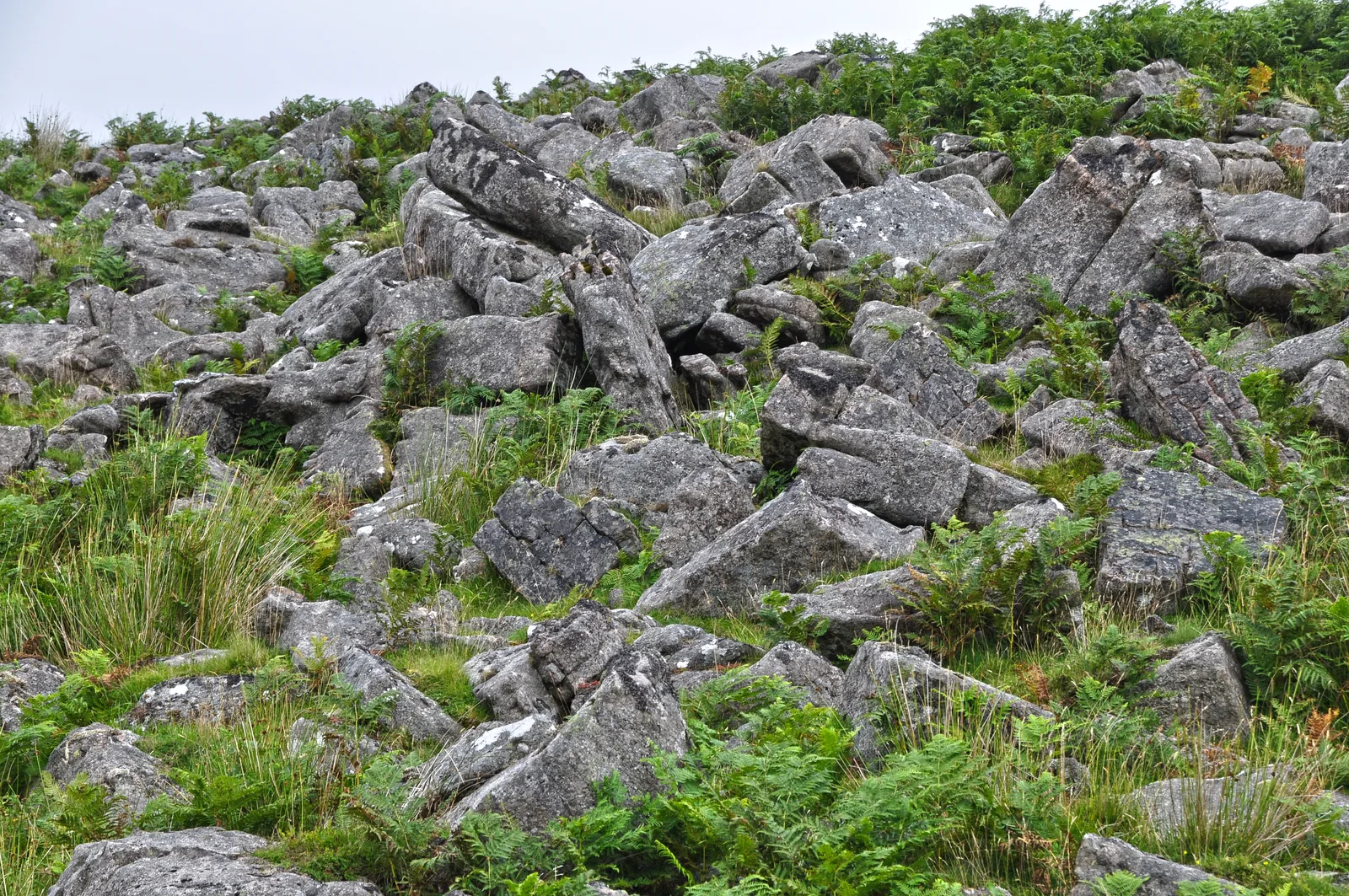
Main image: West Devon, Dartmoor Scenery - 42 metres from location - image by Lewis Clarke (CC BY-SA 2.0), via Wikimedia Commons
Historic England's scheduling record (list entry 1011559) describes sixty stone hut circles, three cooking hearths and a post-medieval storage building beside an area of clitter on a south-facing slope above the valley of the River Tavy. It is the greater part of the large unenclosed hut circle settlement at Watern Oke, one of the largest on Dartmoor. It lies in the parish of Dartmoor Forest, about 1.8 km east of Ger Tor.
Fifty-one huts are circular, 1.5 to 6.6 metres across inside. Nine are oval, 2.4 to 6.4 metres long and 1.8 to 4.3 metres wide. The walls average 0.79 metres high. Thirty-four huts contain hearths, five have porches, two have internal partitions, one has a bench and another an annex, and twenty-nine are attached to boundary walls. The three cooking hearths are small stone-lined pits holding burnt stone and charcoal. The storage building is a single room with corbelled walls and a stone lintel roof, 1.2 by 0.9 metres inside and up to 1.3 metres high. It is too small for shelter and is more likely a cache.
In June and July 1905 the Dartmoor Exploration Committee partly excavated fifty-six of the huts, and found a lot of charcoal, cooking stones, pottery and flint. A Romano-British glass bead suggests more than one period of occupation. More huts probably survive north of the monument under peat, but they cannot be identified and are not scheduled.
Crossing's Guide to Dartmoor says the huts were explored in the summer of 1905 by the Rev. Irvine K. Anderson, Rector of Mary Tavy, who encamped here while men dug for many weeks. Anderson's own account, read at Lynton, puts the settlement 400 yards east of where the Tavy and the Rattle Brook meet, running for half a mile, and counts ninety-four huts explored and two unexplored, with connecting walls between many of them.
Sources: Historic England list entry 1011559, which cites Anderson, 'Hut Circle Settlement at Watern Oke' (Devonshire Association Transactions, vol 38, 1906), pages 101 to 113. The Crossing sentence is from Guide to Dartmoor, vol 2 (1914), page 60, and Anderson's count from the same Transactions volume, page 115 of the Library copy.
- Period: Bronze Age
- Status: Scheduled monument (Historic England list entry 1011559)
- Grid reference: SX 5645 8350 (approximate, from the listing's coordinates)
Historic England listed designation: Sixty stone hut circles forming part of an unenclosed settlement at Watern Oke
Contact us if you have information about this listing


Official record
Explore the area
Go deeper with Dartefacts
Dartefacts is a database of Dartmoor sites with far more close-up detail than we can show here, and it is the best place to go deeper. Dartefacts is free to use, and nobody has to pay to look things up. If you want more, a yearly subscription adds 10-figure grid references, map zoom down to 1:25,000 and lists to tick off the places you have visited, and it helps keep the site going. We would encourage you to subscribe.
More Dartmoor resources
Thoughts
Be the first to share a thought about Watern Oke: sixty hut circles.
Share a thought Photograph by Glavind Strachan Photography
“the grand open moor stretching away for miles in sight of all working outside in the garden or on the moor seems to beckon and point plainly to freedom.”
Also on Our DartmoorThe Donkey Sanctuary — A sanctuary devoted to the welfare and rescue of donkeys, set within the rolling landscape of Dartmoor.
Know another Dartmoor place, tor or landmark we should include? Suggest a listing, it is free.
Suggest a listing