

← Browse Rivers & Waterways · Browse the directory
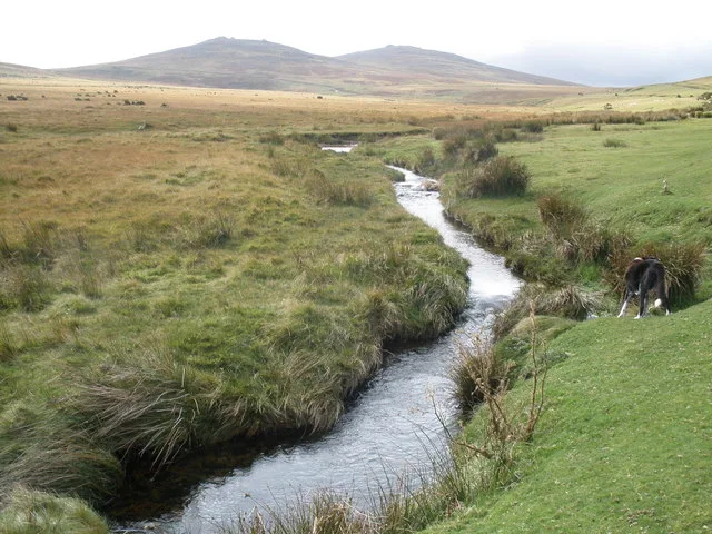
Moor Brook
Okehampton, Devon
Grid ref: SX 5968 9248 Find this on the Map Reference Finder
Main image: Moor Brook. Photograph: Roger Cornfoot.
- Rises: the dip between Row Tor and West Mill Tor
- Flows to: the East Okement, through Halstock Cleave
- Parish: Okehampton
- Upper part: sometimes called the Skid
The Moor Brook comes down from the dip between Row Tor and West Mill Tor; Moor Gate on the common is beside it (Crossing, Guide to Dartmoor, 1914, vol. 1 p. 331). It runs between turf banks to Halstock Cleave, a deep, narrow and thickly wooded valley, and pours into the East Okement in the glen at Belstone. Camp surface water drains into it, and Crossing's Amid Devonia's Alps (1888, p. 229) gives the upper part the name the Skid.
The lower reach has stepping stones, a footbridge, a waterfall and pools. Crossing notes in Gems in a Granite Setting (1905, p. 52) that the whole valley lies in the parish of Okehampton.
Sources: W. Crossing, Guide to Dartmoor (1914) vol. 1 p. 331 and vol. 2 p. 90, Amid Devonia's Alps (1888) p. 229, Gems in a Granite Setting (1905) p. 52; An Exploration of Dartmoor and its Antiquities p. 71; Wright, Barony and Town of Okehampton p. 175; Holiday in Dartmoor.
Suggest an edit to this listing
Contact us if you have information about this listing
Official record
Explore the area
Go deeper with Dartefacts
Dartefacts is a database of Dartmoor sites with far more close-up detail than we can show here, and it is the best place to go deeper. Dartefacts is free to use, and nobody has to pay to look things up. If you want more, a yearly subscription adds 10-figure grid references, map zoom down to 1:25,000 and lists to tick off the places you have visited, and it helps keep the site going. We would encourage you to subscribe.
Thoughts
Be the first to share a thought about Moor Brook.
Share a thoughtKnow another Dartmoor place, tor or landmark we should include? Suggest a listing, it is free.
Suggest a listing