

← Browse Prehistoric Settlements · Browse the directory

Hut circles and settlements near Merrivale Bridge
Dartmoor Forest, Tavistock, Devon
Grid ref: SX 5560 7504
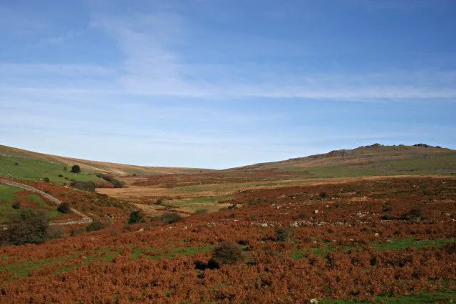
Main image: Photo: Tony Whitman (CC BY-SA 2.0) via Wikimedia Commons
- Period: Bronze Age, with later farm and quarry remains
- Status: Eight scheduled monuments (Historic England entries listed below)
- Huts: At least 36 stone hut circles in the main settlement, plus outliers and isolated huts
East of Merrivale Bridge, on the gentle west-facing slope of Over Tor above the River Walkham, Historic England records a large partially enclosed hut circle settlement. The main monument alone has at least 36 hut circles and four separate enclosures, with a round cairn, a post-medieval farmstead and pits where millstones were cut. Several huts and an enclosure with three huts are scheduled as outlying parts of it, and two isolated huts with slab-lined doorways stand further east on Longash Common.
The monuments in this area are sometimes known together as Merrivale Antiquities. The stone rows, standing stone, stone circle and a ring cairn have their own listings, linked below.
The eight scheduled monuments
| Historic England entry | Grid reference | What survives |
|---|---|---|
| 1013427 | SX 55551 74979 | The main settlement: at least 36 hut circles and four enclosures (the north-western one 53 m by 29 m), a round cairn, a post-medieval farmstead and millstone and stone cutting pits. |
| 1013428 | SX 55657 75121 | An outlying hut 7.4 m across inside, wall 2 m wide and up to 1 m high, with a south-facing doorway gap. |
| 1014669 | SX 55505 75168 | An outlying hut 5.5 m across inside, wall 1 m wide and up to 0.9 m high. |
| 1014670 | SX 55586 75158 | An outlying hut 6.3 m across inside, wall 1.6 m wide and up to 1.15 m high. |
| 1014671 | SX 55553 75205 | A sub-circular enclosure 38 m by 32 m with a slab-faced wall, linking three hut circles that are older than it. |
| 1019569 | SX 55289 75199 | A prehistoric settlement of at least four huts within a field system of large rubble walls, with a cairn and three pillow mounds, inside Merrivale Newtake. |
| 1013432 | SX 55809 74765 | An isolated hut 5.6 m across inside, wall 1.4 m wide and up to 0.8 m high, one side formed by a boulder, with a slab-lined doorway. |
| 1013433 | SX 55920 74729 | An isolated hut 7 m across inside, wall 1.4 m wide and up to 1 m high, with a slab-lined doorway facing south-south-east. |
Grid references are from the Historic England entries. Each entry covers one scheduled monument; a monument can hold several features.
Contact us if you have information about this listing



The 8 rings on this map are the separate scheduled monuments that make up this listing, placed from Historic England’s records. Tap a ring for its grid reference and a link to its official entry. The pin marks the middle of the group.
Official record
Explore the area
Go deeper with Dartefacts
Dartefacts is a database of Dartmoor sites with far more close-up detail than we can show here, and it is the best place to go deeper. Dartefacts is free to use, and nobody has to pay to look things up. If you want more, a yearly subscription adds 10-figure grid references, map zoom down to 1:25,000 and lists to tick off the places you have visited, and it helps keep the site going. We would encourage you to subscribe.
Thoughts
Be the first to share a thought about Hut circles and settlements near Merrivale Bridge.
Share a thoughtKnow another Dartmoor place, tor or landmark we should include? Suggest a listing, it is free.
Suggest a listing