

← Browse Tors & Landmarks · Browse the directory
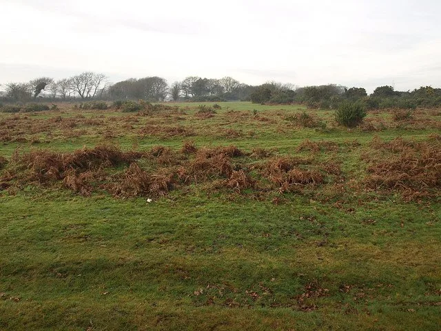
Roborough Down
Yelverton, Devon
Grid ref: SX 5120 6540 Find this on the Map Reference Finder
Main image: Roborough Down. Photograph: Derek Harper.
- Near: Yelverton
- Grid reference: about SX 512 654 (the centre of a large area)
- Owner: Maristow Estate (Lord Roborough)
- Boundary: inside the National Park
Roborough Down is open moorland crossed by the A386 between Yelverton and Plymouth, inside the National Park but owned by the Maristow Estate. Roborough Rock stands at the southern end of the former RAF Harrowbeer airfield here. The down holds Bronze Age hut circles, enclosures and cairns, Roborough Camp, medieval longhouses, post-medieval mining, the wartime airfield with a decoy site and prisoner-of-war camp, and the remains of Drake's Leat.
Drake's Leat, completed in 1591, brought water 17 miles from a weir on the Meavy near Sheepstor across the down to Plymouth. Witnesses in the 1590s described the down as extending over land now enclosed. Yelverton takes its name from Elford Town, once a property on the edge of the down. Roborough stone, a quartz-rich elvan, was quarried on the down between Hoo Meavy and Bickham and used at Buckland Abbey and St Mary's, Bickleigh.
Sources: Wikipedia, Roborough, South Hams and Roborough Rock; Tavistock Today, habitat and archaeology of Roborough Down; Dartmoor: A New Study (1977) p. 264; Transactions of the Devonshire Association vol. 16 (1884) p. 625; Dartmoor Society newsletter 64 p. 12.
Contact us if you have information about this listing
Official record
Explore the area
Go deeper with Dartefacts
Dartefacts is a database of Dartmoor sites with far more close-up detail than we can show here, and it is the best place to go deeper. Dartefacts is free to use, and nobody has to pay to look things up. If you want more, a yearly subscription adds 10-figure grid references, map zoom down to 1:25,000 and lists to tick off the places you have visited, and it helps keep the site going. We would encourage you to subscribe.
Thoughts
Be the first to share a thought about Roborough Down.
Share a thought Photograph by Glavind Strachan Photography
“The granite tors still lift their lofty heads to the sky, the heather and gorse still bloom on the moor, the stream yet pursues its way over its rocky bed, and all is here unchanged.”
Also on Our DartmoorDirection Post — A stone direction post at a remote five-way junction on Dartmoor, marking routes across the high moor.
Know another Dartmoor place, tor or landmark we should include? Suggest a listing, it is free.
Suggest a listing