

← Browse Bittaford · Browse Tors & Landmarks · Browse the directory
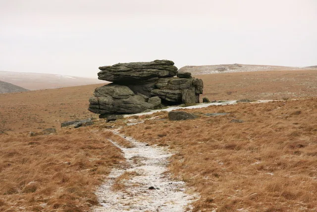
Hangershell Rock
Bittaford, Devon
Grid ref: SX 6549 5935
On walking routes: Two Moors Way
Main image: Hangershell Rock - 20 metres from location - image by Guy Wareham (CC BY-SA 2.0), via Wikimedia Commons
The name has evolved over time, with early records showing it as 'Hanger's Shiel' in the 1500s, and later as 'Hangershill' in the 1800s.
- Grid reference: SX 6549 5935 (approximate, from the listing's coordinates)
Thoughts
Be the first to share a thought about Hangershell Rock.
Share a thoughtKnow another Dartmoor place, tor or landmark we should include? Suggest a listing, it is free.
Suggest a listing