

← Browse Prehistoric Settlements · Browse the directory
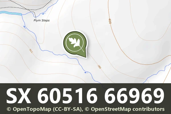
Historic England's scheduling record (list entry 1016145) describes a prehistoric settlement, three ring cairns, six round cairns, a post-medieval tin mill, a set of streamwork earthworks and several tinners' buildings beside the Langcombe Brook, where it joins the River Plym. It lies across the parishes of Shaugh Prior and Sheepstor, about 0.7 km south-west of Calveslake Tor.
The settlement has three simple enclosures, two with hut circles. Six round cairns, 0.2 to 0.6 metres high, stand between the enclosures. Two ring cairns lie by the huts in the eastern enclosure and each holds a cist. The third ring cairn is north of the northern enclosure and is 16 metres across inside.
The tin mill lies close to the Plym, a rectangular building with a clear wheel pit and a mortar stone against the outside of the west wall. Earthworks just south of the mill may be the dressing floor. The mill is later than the streamwork in this area, which is a set of parallel banks at right angles to the river. The streamwork in the Langcombe Brook survives in separate areas of parallel banks, lying along the brook at the north end, at 45 degrees to it in the middle with big boulders holding up their downstream side, and either parallel or at right angles to it at the south, unrevetted. At least five rectangular or oval buildings are built into the streamwork and are taken to be the shelters and stores of the tinners who worked it, and one more shelter was built into an older, disused hut circle.
Sources: Historic England list entry 1016145, which cites Butler, Dartmoor Atlas of Antiquities (1994), pages 148 to 150, Gerrard in Devon Archaeological Society Proceedings, vol 52 (1994), page 179, and Thackray, The Upper Plym Valley (1994), Archaeological Site Inventory. Visitor comments by Sandy Gerrard on the Historic England page describe the preserved streamwork and a cairn and cist at SX 6078 6688; I have not used them.
- Period: Prehistoric
- Status: Scheduled monument (Historic England list entry 1016145)
- Grid reference: SX 6051 6696 (approximate, from the listing's coordinates)
Contact us if you have information about this listing


Official record
Explore the area
Go deeper with Dartefacts
Dartefacts is a database of Dartmoor sites with far more close-up detail than we can show here, and it is the best place to go deeper. Dartefacts is free to use, and nobody has to pay to look things up. If you want more, a yearly subscription adds 10-figure grid references, map zoom down to 1:25,000 and lists to tick off the places you have visited, and it helps keep the site going. We would encourage you to subscribe.
More Dartmoor resources
Thoughts
Be the first to share a thought about Langcombe Brook settlement, ring cairns and tin mill.
Share a thoughtKnow another Dartmoor place, tor or landmark we should include? Suggest a listing, it is free.
Suggest a listing