

Staying Safe on Dartmoor
Good to Know
Dartmoor is still a working landscape as well as a wild one. A couple of things that can catch people out who don't know the moor: the Military still fires live ammunition on parts of it (there are three ranges), and after heavy rain some of its rivers can carry storm-overflow discharge.
There are plenty of other hazards, but these are two you can be forwarned about! Neither should keep you away - you just want to know how to check before you set off.
We've built the live map and the on-site alerts because this is exactly the sort of thing a directory of "Everything" Dartmoor should tell you, without doing any digging.
Here's what the two hazards actually are, and how to check them in seconds.

Live firing on Dartmoor
Three areas of the northern moor - the Okehampton, Merrivale and Willsworthy ranges - are part of the Ministry of Defence's Dartmoor Training Area, and the Army uses them for live firing on scheduled days through much of the year. The rest of the moor is not used for firing, though if you're lucky you will see the Military training on other parts of the moor, or flying over it. All my interactions with them over the years has been very pleasant and polite.
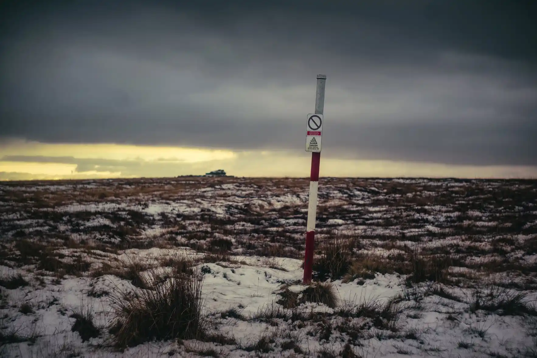
When firing is taking place, the boundary of the danger area is marked by red flags by day and red lamps at night. If the flags or lamps are up, do not enter or stay in that area - firing can include heavy weapons, and the danger area exists for a reason.
Even as a seasoned walker and Hill & Moorland Leader, I've been caught out forgetting to check the Firing Times and had to alter my walking route appropriately - so it's worth keeping in mind whatever you have planned.
Before you walk in a range
- Check the firing times. They're published well in advance and updated regularly - see the live map below, or the official GOV.UK schedule.
- Look for the flags and lamps. Red flag by day, red lamp by night on the range boundary means firing - keep out.
- Freephone the answering service on 0800 458 4868 for the latest firing information.
- Never pick up metal objects you find on the ranges. Military debris - including unexploded items - can look harmless. Don't touch it; note where it is and report it.
None of this makes the northern moor off-limits - on non-firing days some of my favourite walks on Dartmoor are in the ranges, and much of the training area is open access land. It just makes sense to check first.
River health & storm overflows
First off, most of Dartmoor's rivers do not have any overflows into them - If you look at the map, you'll see this. The closer you get to civilisation, the more chance there will be some poop in the river.
This doesn't discount dead animals being in the water, or poop from animals in general - don't drink any of the water without boiling it, filtering it or using serilising tablets (or all three) - General rule - don't drink the water!
Dartmoor's rivers are one of the best things about it (They can be really dangerous when in flood) - but they sit at the top of catchments that, further down, pass through the water network. During and after heavy or prolonged rain, storm overflows can discharge diluted, untreated sewage into watercourses. It's a deliberate release valve - it stops sewage backing up into homes when the system is overwhelmed - but it can affect water quality for a while afterwards.
This matters most if you swim, paddle, or let a dog swim - especially in the day or two after a big downpour. It's not a reason to avoid the rivers (personally I prefer to enjoy my life, not sit in a room worrying about everything); however, it's a good idea to glance at the data first, the same way you'd check the weather.
Before you get in the water
- Check after rain. Overflows are most likely during and shortly after heavy rainfall.
- Use the live layer. Our map's River health layer shows which storm overflows are discharging now, or have in the last 24 hours - most sit around the edges of the moor, where the rivers meet the towns.
- When in doubt, wait a day. Water quality usually recovers once the discharge stops and the river flushes through.
Storm-overflow data © the water companies, via the National Storm Overflow Hub (streamwaterdata.co.uk), used under CC BY 4.0.
Check it all in one place
Both of these are live on our map. Turn on the Military firing ranges layer and the ranges colour themselves from the day's schedule - a slowly-flashing "Live firing today" warning appears when firing is on, and the range that's firing right now pulses red. Turn on River health and you'll see the storm-overflow monitors, colour-coded for what's spilling now.
You'll also see a floating Dartmoor Alert on the site when either hazard is live - a quick heads-up as you arrive, with a link straight to the map with the right layers already switched on.
Open the live safety map Official firing times (GOV.UK)
Dartmoor rewards those who prepare - check the flags, check the rain, grab a map and compass and enjoy.