

← Browse Prehistoric Settlements · Browse the directory
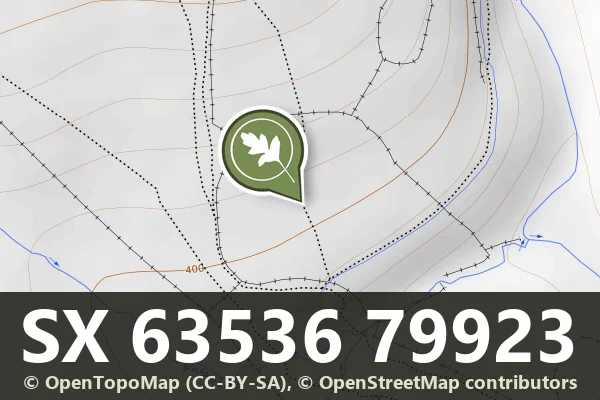
Historic England's scheduling record (list entry 1021333) describes a prehistoric enclosed settlement, a cairn, a short length of leat and post-medieval walling on a south-facing slope above the valley of the East Dart River. The enclosure is a circular area bounded by a rubble bank up to 5 metres wide and 0.5 metres high, 300 metres north-east to south-west by 260 metres north-west to south-east inside. It holds at least 36 hut circles, 2.5 to 6.6 metres across inside, eleven with visible doorways and two attached to the outer face of the enclosure. The Dartmoor Exploration Committee part excavated eleven of the huts in 1894 and found hearthstones, charcoal, flints, rubbing stones and pot boilers. It lies in the parish of Dartmoor Forest, about 0.6 km west of Hartland Tor and 1.7 km north-west of Postbridge.
A post-medieval drystone wall, up to 1.5 metres high, runs along the inner face of the enclosure wall for much of its circuit, and a small drystone animal pen stands against the north wall. Next to the south side is a stony cairn 5.5 metres across and up to 0.8 metres high, clipped on its north side by a leat that carried water to the gunpowder mills at Cherry Brook.
Sources: Historic England list entry 1021333, which cites Butler, Dartmoor Atlas of Antiquities (1991), pages 39 to 40, and the National Monuments Record monument report SX 67 NW 220 (2003). Sandy Gerrard has dated his photograph to 25 March 2003 in a comment on the Historic England page; I have not used it.
- Period: Prehistoric
- Status: Scheduled monument (Historic England list entry 1021333)
- Grid reference: SX 6353 7992 (approximate, from the listing's coordinates)
Contact us if you have information about this listing


Official record
Explore the area
Go deeper with Dartefacts
Dartefacts is a database of Dartmoor sites with far more close-up detail than we can show here, and it is the best place to go deeper. Dartefacts is free to use, and nobody has to pay to look things up. If you want more, a yearly subscription adds 10-figure grid references, map zoom down to 1:25,000 and lists to tick off the places you have visited, and it helps keep the site going. We would encourage you to subscribe.
More Dartmoor resources
Thoughts
Be the first to share a thought about Broadun enclosed settlement, Archerton.
Share a thoughtKnow another Dartmoor place, tor or landmark we should include? Suggest a listing, it is free.
Suggest a listing