

Dartmoor quiz
What is the earliest known name for the Walla Brook near Wallabrook Clapper Bridge?


← Browse Stone Rows & Alignments · Browse the directory
Grid ref: SX 6551 8423 Find this on the Map Reference Finder
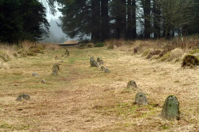
Main image: Fernworthy Stone Row - 39 metres from location - image by Dave Farmer (CC BY-SA 2.0), via Wikimedia Commons
A popular claim once held that these rows linked Fernworthy Circle to Scorhill Circle. The antiquarian R. Hansford Worth tested this in 1932, after surveying all three sites directly, and rejected it: "I can find no evidence in support of this statement."
Contact us if you have information about this listing
Dartefacts is a database of Dartmoor sites with far more close-up detail than we can show here, and it is the best place to go deeper. Dartefacts is free to use, and nobody has to pay to look things up. If you want more, a yearly subscription adds 10-figure grid references, map zoom down to 1:25,000 and lists to tick off the places you have visited, and it helps keep the site going. We would encourage you to subscribe.
Be the first to share a thought about Fernworthy Stone Row.
Share a thoughtWhat is the earliest known name for the Walla Brook near Wallabrook Clapper Bridge?
Know another Dartmoor place, tor or landmark we should include? Suggest a listing, it is free.
Suggest a listing